
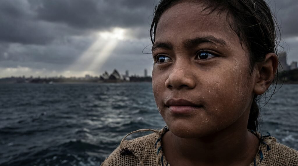
Earth Files—Tuvalu: The First Nation Losing Its Land to the Rising Sea Levels
For the first time in modern history, a country is preparing for the loss of its entire physical territory. The Pacific island nation of Tuvalu, made up of low-lying coral atolls, is facing projected submergence within the coming decades as sea levels continue to rise. Climate models suggest that by around 2050, much of Tuvalu’s land could become uninhabitable, forcing its people to leave the islands their ancestors have lived on for centuries.
In response, Tuvalu has taken an unprecedented step. Through the Falepili Union Treaty with Australia, it has launched the world’s first organized climate migration pathway. Under this agreement, 280 Tuvaluans per year will receive permanent residency in Australia, along with access to healthcare, education, and employment. The demand reflects the urgency; more than 8,700 people applied when the first climate visa ballot opened, highlighting how quickly rising seas are turning survival into a race against time.

At the same time, Tuvalu is redefining what a nation can be. The government is building the world’s first digital nation, 3D-scanning its islands, digitizing state institutions, and updating its constitution to preserve sovereignty even if the land disappears. As global sea levels now rise at twice the rate measured in the early 1990s, Tuvalu stands as a warning for coastal regions everywhere, a reminder that climate change is no longer a distant future but a present reality reshaping nations themselves.
Source: Prada, L. (2025, July 29). This Entire Country Has to Be Evacuated Because of Climate Change. Giant Freakin Robot
#EarthFiles035 #DeepInSpace #Tuvalu #ClimateChange
Engineering the Impossible: How fleets of industrial ships built fully functional military bases and runways in the middle of the deep blue ocean.
For more than a decade, China has been reshaping parts of the South China Sea using one of the simplest materials on Earth: sand. By dredging huge amounts of sediment from the seabed and pumping it onto shallow reefs, China transformed submerged coral formations into permanent artificial islands. What once appeared only at low tide has become solid ground hosting runways, ports, radar systems, and buildings. Satellite imagery shows that between 2013 and 2016 alone, over 1,200 hectares of new land were created in the Spratly Islands, a dramatic example of large-scale land reclamation rarely seen in modern history.

From an engineering perspective, the process is straightforward but extreme. Powerful dredgers vacuum sand from the ocean floor and deposit it layer by layer onto reefs, which are then compacted and reinforced with concrete and rock barriers to resist waves and erosion. Once stabilized, infrastructure follows: airstrips, harbors, power systems, desalination plants, and even vegetation planted in imported soil. Scientifically, these structures are not “natural islands” but artificial platforms that require constant maintenance to survive harsh marine conditions. Environmentally, studies show this dredging has caused severe damage to coral ecosystems, fisheries, and water quality across the region.
Beyond engineering, the significance is geopolitical. Under international law, natural islands can generate territorial claims, while artificial islands do not, yet their presence allows permanent military and logistical operations far from mainland coasts. Facilities labeled as civilian often coexist with radar domes, missile systems, and hardened shelters. The result is a new strategic reality in one of the world’s busiest and most contested seas, built not by volcanic forces or tectonics, but by human machinery and ambition.
Source:
NASA Earth Observatory; CSIS Asia Maritime Transparency Initiative; Permanent Court of Arbitration (South China Sea Arbitration); peer-reviewed environmental studies on coral reef dredging
👉 For more fascinating insights into space, Earth science, and the hidden forces shaping our world, follow Deep In Space—The Science Hu