
Megatsunami Debris Found 1,000ft Above Sea Level | Hawaii News
BIG BREAKING Scientists have discovered tsunami debris 1,000 feet above sea level on this Hawaiian island.
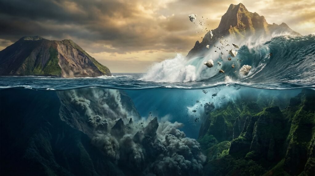
What kind of wave could possibly throw chunks of coral a thousand feet up a mountainside? It would have to be enormous The mystery led researchers to the deep waters southwest of the Big Island of Hawaii. Using side-scan sonar, seismic reflection profiles, and detailed bathymetric maps, scientists surveyed roughly 1,544 square miles (4,000 km2) of seafloor.
What they found was staggering: evidence of a catastrophic collapse stretching nearly 60 miles (97 km) across the ocean floor-one of the largest volcanic landslides in the entire Pacific Basin. The terrain left behind is unmistakable-hummocky ridges, levees, and lobate terraces that look strikingly similar to landslides on land, revealing how fast and powerfully these underwater avalanches moved.
The slide occurred in two overlapping “lobes,” each 165-656 feet (50-200 m) thick. Their geometry suggests they collapsed in rapid succession from the same point on the island’s flank. Closer to shore, huge slumped blocks of crust record multiple collapse events before, during, and after the slides.
In total, these slumps and slides displaced 360-480 cubic miles (1,500-2,000 km°) of material-enough to bury New York City under a mile of rock. Researchers believe this colossal collapse, known as the Alika Slide, generated a megatsunami that slammed into the island of Lanai, sweeping coral rubble nearly a thousand feet upslope.